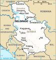
Òbrôzk:Serbia-CIA WFB Map 2006.png
Serbia-CIA_WFB_Map_2006.png (328 × 352 pikslów, miara lopka: 24 KB, ôrt MIME: image/png)
Historëjô lopka
Klëkni na datum/czas, abë òbaczëc jak wëzdrzôł lopk w tim czasu.
| Datum/Czas | Miniatura | Miara | Brëkòwnik | Òpisënk | |
|---|---|---|---|---|---|
| aktualny | 20:03, 15 cze 2017 |  | 328 × 352 (24 KB) | Кликери | Reverted to version as of 09:17, 20 June 2009 (UTC) |
| 18:56, 15 cze 2017 |  | 326 × 350 (33 KB) | Hakuli | Serbia map - CIA 2017 | |
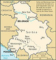
| 11:17, 20 cze 2009 |  | 328 × 352 (24 KB) | Mike Babic~commonswiki | {{Information |Description=CIA World Factbook map from 2006. It shows Kosovo as an autonomous province of Serbia. Kosovo declared itself independence on February 17, 2008. This is recognized by the United States and some other nations. The most recent | |
| 15:27, 25 str 2008 |  | 328 × 352 (16 KB) | Mattflaschen | {{Information |Description=CIA World Factbook map from 2006. It shows Serbia as an autonomous province of Serbia. Kosovo declared itself independence on February 17, 2008. This is recognized by the United States and some other nations. The most recent |
Lënczi do lopka
Niżódnô starna nie lënkùje do negò lopka.
Globalné wëzwëskanié lopka
Nene lopk je téż brëkòwnóny w jinnych ùdbach Wiki:
- Wëzwëskanié w ca.wikipedia.org
- Wëzwëskanié w de.wikipedia.org
- Wëzwëskanié w en.wikipedia.org
- Wëzwëskanié w fa.wikipedia.org
- Wëzwëskanié w hr.wikipedia.org
- Wëzwëskanié w ja.wikipedia.org
- Wëzwëskanié w mk.wikipedia.org
- Wëzwëskanié w ms.wikipedia.org
- Ada (Serbia)
- Mol (Serbia)
- Obornjača (Ada)
- Utrine (Ada)
- Cerovac (Aerodrom)
- Aerodrom, Kragujevac
- Cvetojevac
- Čumić
- Desimirovac
- Donje Grbice
- Gornje Grbice
- Gornje Jarušice
- Jovanovac (Aerodrom)
- Lužnice (Aerodrom)
- Mali Šenj
- Mironić
- Novi Milanovac
- Opornica
- Pajazitovo
- Poskurice
- Resnik (Aerodrom)
- Šljivovac (Aerodrom)
- Aleksandrovac
- Bobote
- Boturići
- Dobroljubci
- Bratići
- Bzenice
- Dašnica (Aleksandrovac)
- Donja Zleginja
- Donje Rataje
- Donji Stupanj
- Donji Vratari
Pòkôżë lëstã glonal;negò brëkwaniô negò lopka.


